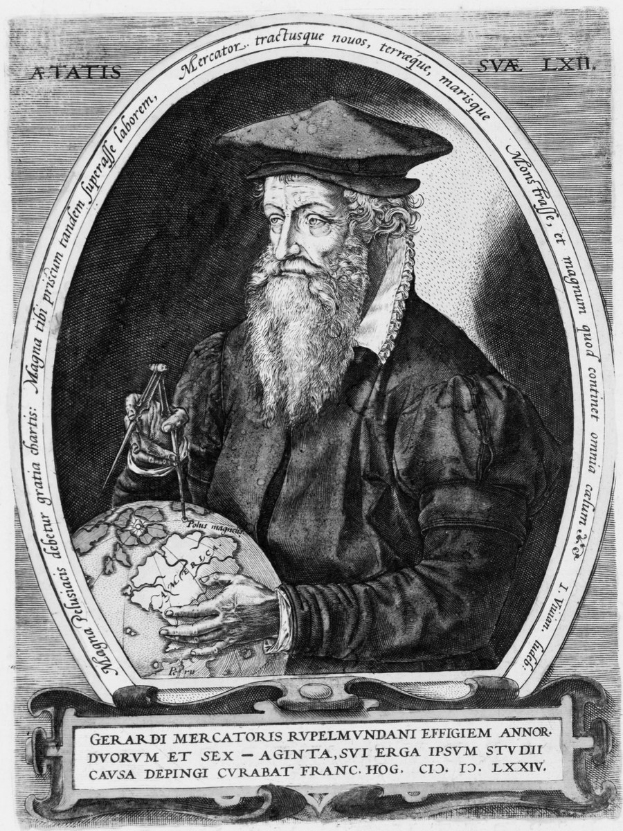
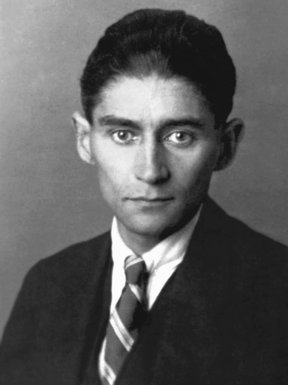
Portrait of Gerardus Mercator at age 62, engraving dated 1574, impression from the 1595 Atlas, Library of Congress Prints and Photographs Division (LCCN 2006675892), public domain · Engraved portrait of Gerardus Mercator at the age of 62, half-length with dividers and a globe, in an oval inscribed 'Aetatis suae LXII' with a cartouche stating that Frans Hogenberg had the portrait of Gerardi Mercatoris Rupelmundani painted in 1574; Library of Congress Prints and Photographs Division, LCCN 2006675892, an impression illustrated in the 'Atlas sive Cosmographicae meditationes' (Duisburg, 1595), item-level date 1595. The engraver is not named on the Library's record. It is a lifetime portrait dated 1574 and identified by its own inscription. The file is the Library's 3283 x 4096 master scan cropped to the plate and cartouche and downscaled to 900 x 1200 with no upscaling. · Public domain (engraving dated 1574 and printed in 1595, public domain by age)
학자 · 근세
게라르두스 메르카토르
1512–1594
주요 업적 분야
아직 성격 매칭에 포함되지 않았습니다 — 기록된 근거가 성격 모델 전체를 다루기에는 충분하지 않습니다. 이 페이지의 다른 모든 내용은 자유롭게 확인하실 수 있습니다.
핵심 특성
주요 업적
그는 1569년 항해자를 위한 대형 세계 지도를 발표했는데, 일정한 나침반 방위의 항로가 직선으로 나타나는 이 도법은 그의 이름을 땄고, 해도는 지금도 이를 쓴다.
그는 지구의와 과학 기구를 만들고 팔레스타인, 플랑드르, 유럽, 브리튼 제도 지도와 이탤릭 서체 교본을 펴냈으며, 1552년부터 뒤스부르크에서 자신의 조각공들을 둔 지도 제작 공방을 운영했다.
그는 세계의 창조와 역사를 설명하는 여러 부분의 《아틀라스》를 구상했으나 1594년 세상을 떠날 때 미완성이었고, 아들 루몰트가 1595년 이를 완성해 펴냈으며, 지도 모음을 뜻하는 '아틀라스'라는 말이 여기서 나왔다.
삶의 장면들
그는 24세에 이미 뛰어난 조각가이자 서예가, 기구 제작자였고, 1540년에는 자신의 이탤릭 서체 교본의 목판을 직접 새겼다.
이는 여러 기술을 경력 초기에 높은 수준으로 끌어올린 장인의 모습과 일치한다. 숙련 지향
뒤스부르크에서 그는 지도 제작과 함께 공작을 위한 계보 연구를 하고, 《복음서 조화》와 로마서 주석을 쓰고, 1559년부터 1562년까지 문법학교에서 수학을 가르쳤다.
이는 지리, 수학, 신학에 걸쳐 일한 학자의 모습과 일치한다. 분야 횡단성
전환점
그는 1552년 뒤스부르크로 영구 이주해 자신의 조각공들을 둔 지도 제작 공방을 세웠고, 이곳에서 유럽과 브리튼 제도 지도, 1569년 세계 지도, 《아틀라스》의 여러 부분을 만들어냈다.
이는 루뱅의 장인에서 긴 출판 계획을 이어가는 공방의 책임자로 옮겨간 전환과 일치한다. 끈기
비슷한 인물
전체적인 프로필이 이 사람과 닮은 사람들이에요.


라빈드라나트 타고르

에이다 러브레이스

루이 파스퇴르

마야 안젤루

프란츠 카프카
출처
- Gerardus Mercator (Q6353), verified live via the Wikidata API (2026-11-01): label 'Gerardus Mercator', description 'Flemish geographer, cosmographer and cartographer (1512-1594)', born 1512-03-05, died 1594-12-02 (day precision), Korean label 게라르두스 메르카토르, images include the Larmessin engraving from the Wellcome Collection. Orientation only; not used as support for any row.
- Encyclopaedia Britannica, 'Gerardus Mercator', read in full from an Internet Archive copy because the live page returns HTTP 403 to the fetch tool. CANONICAL SIGNIFICANCE SOURCE: Flemish cartographer 'whose most important innovation was a map, embodying what was later known as the Mercator projection' (the 1569 world map), who also introduced the term 'atlas' for a collection of maps; born Rupelmonde 5 March 1512, died Duisburg 2 December 1594; studied at Leuven under Gemma Frisius, by 24 'a superb engraver, an outstanding calligrapher, and a highly skilled scientific-instrument maker', built globes with Frisius and Gaspar a Myrica in 1535-37, published maps of Palestine (1537), the world (1538) and Flanders (about 1540) and an italic-lettering manual (1540, wood blocks engraved by himself); moved permanently to Duisburg in 1552, set up a cartographic workshop with his own engravers, helped design a grammar-school curriculum, published a map of Europe (1554), taught mathematics at the school 1559-62, did genealogical research for the duke, wrote a Concordance of the Gospels and a commentary on Romans, was appointed court cosmographer in 1564, published the 1569 world map and then an Atlas planned as a series (chronology 1569, Ptolemy's maps 1578, new maps 1585 and 1589) that was 'never fully realized' and completed by his son Rumold in 1595. Scholarly reference voice; praise of significance is retrospective. The 1544 heresy arrest it also reports is not scored.
- George Kish, 'Mercator, Gerardus', Complete Dictionary of Scientific Biography (Charles Scribner's Sons, 2008), read in full via the MacTutor/Encyclopedia.com copy: studied philosophy and theology at Louvain, then mathematics and astronomy informally under Frisius, and became skilled as an engraver; 'a man of many talents' whose contributions to calligraphy and engraving 'influenced several generations of artisans'; 'undoubtedly the most influential of cartographers'; made world maps, globes, instruments and had a reputation as a surveyor; in Duisburg he became cosmographer to the Duke of Cleves, published maps of Europe and Britain and an edition of Ptolemy; the 1569 map was designed for seamen, on a cylindrical projection in which a line of constant bearing is straight and distortion grows toward the poles; the collection published by his son Rumold in 1595 was the first use of the word 'atlas' for a collection of maps; the entry points to Averdunk and Muller-Reinhard (1914) as the authoritative biography. Scholarly dictionary entry.
- Elisabeth Hodges, 'Mercator Publishes His World Map' (EBSCO Research Starters, 2022), read in full: the 1569 'Nova et aucta orbis terrae descriptio ad usum navigantium emendate accomodata' was an 18-sheet copper-engraved wall map (131 x 208 cm) dedicated to Duke Wilhelm of Cleves with extensive legends; Mercator was 'less interested in producing an accurate graphic image of the earth than producing a map that would facilitate navigation' (in contrast to Ortelius); how he developed the projection is conjecture (generally accepted: by experimenting with the spacing of meridians and parallels on his 1541 globe); the earlier 1538 map used a double heart-shaped projection already used by Finé in 1531; the projection distorts landmass sizes toward the poles (Greenland appears as large as China) and in the 1970s Arno Peters proposed an alternative; Edward Wright's 1599 tables spread the projection and virtually all nautical charts now use it. Educational reference with the distortion critique.
- Linda Hall Library, 'Scientist of the Day: Edward Wright' (8 October 2025), read in full: the 1569 map was 'a navigator's dream' because rhumb lines are straight, but 'Mercator did not explain how he did it', so the map 'stood alone for 30 years (except for a multitude of botched copies)' until Edward Wright worked out the mathematics in the early 1590s and published tables in 1599. Independent library voice and the limit on Mercator's own contribution.
- Susan Gole (International Map Collectors' Society), 'Pole to pole in curious curves', Times Higher Education, 2 September 2005, a review of Andrew Taylor's 'The World of Gerard Mercator', read in full: after the 1569 map he turned to a chronology, a revised Ptolemy and a new geography rather than leaving a mathematical theory of the projection; he was often away at fairs selling globes and maps, gathering information to correct previous errors and corresponding with scholars, and engraved many maps himself until his children could help; his preface told the story of Atlas the philosopher-king; the reviewer notes that the bare facts of his life come largely from a 'hagiographical account written by a friend soon after his death'. Independent reviewer voice with the hagiography caveat.
- University of Duisburg-Essen, 'Die Biographie Walter Ghims' (Erinnerungsort Mercator project), read in full in German: analyses the first Mercator biography, Walter Ghim's 1595 Latin 'Vita Mercatoris' printed in the Atlas (Ghim was Duisburg's mayor and Mercator's neighbour); the first part lists his works with the emphasis on maps, globes and instruments, the second his gentle character, charity, hospitality and constant industry ('Ghim never found him idle'); it cites Marc Monmonier that the Vita is 'more a long obituary than a critical biography'. Used as the evaluation of the contemporary biography, whose claims about his character are laudatory and are not scored as behaviour.